Hiking in Asturias
The Bear Trail on Foot
Everything you need to know to walk the most spectacular Greenway in Northern Spain. Real times, recommended sections, and how to organize the return.
Is it a good idea to travel it walking?
Absolutely. Although the route has 50 kilometers (31 miles) in total counting its branches (practically unreachable in a single day on foot), it is perfectly adapted for walkers thanks to its status as a Greenway.
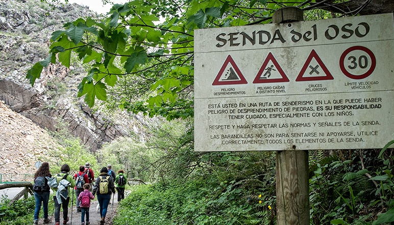
Safety First
Being based on an old railway platform, there is no motorized traffic, which makes it 100% safe for pedestrians and families with kids. However, keep in mind that you will share the journey with cyclists, so it is vital to always walk on the right and pay attention in narrow curves.
Highlights
Walking Route Options
Select the itinerary that best suits your time, physical condition, and the people accompanying you.
Short walk to see bears 🐻
FamilyThe perfect option if you travel with very young children or just want to make an express visit.
- From Buyera Rec. Area (Villanueva): 800 m (15 min)
- From Proaza: 2.5 km per way (5 km round trip)
Tip: Plan your arrival around 12:00 h, which usually coincides with the Feeding time when the bears are most active.
Medium Route: Up to the Enclosure 🥾
ModerateA beautiful walk along the valley floor next to the Trubia river, combining lush nature with fauna observation.
- From Tuñón Recreational Area:
- Distance: 5 km per way (10 km total)
- Duration: About 2.5 - 3 hours at a leisurely pace.
A Full Valley Journey 🎒
DemandingRecommended for regular hikers. It allows you to know the most dramatic points of the route, such as the large pure rock gorges.
- Route (e.g., Tuñón - Entrago or vv.): about 20 km.
- Duration: Around 5 hours at a constant pace (4 km/h).
The section from Entrago crossing the Valdecerezales Gorge is visually spectacular.
The linear route dilemma: Return Options
The Bear Trail is shaped like an inverted 'Y' and is not circular. This means that if you do 10 km one way, you have to do another 10 km back the same way... unless you plan an alternative for your return.
Ready for adventure?
Download your map and start walking
No physical maps are sold in the area; we recommend viewing and downloading our digital map of the Bear Trail on your phone.
Hikers' Opinions

"Totally recommended. Simple route to do and with impressive views and landscapes!! The staff very friendly and professional."
"Great experience. We rented bikes to do the trail and they explained everything very well. We loved the route."
Common Questions
Frequently Asked Questions
We solve the most common doubts so that your getaway to the Bear Trail is perfect.
How many kilometers long is the Bear Trail?
The Bear Trail is Y-shaped and offers several options. The most popular route is the 20 km descent from Tuñón to Entrago, perfect for families by bike in about 2.5 hours. More active visitors can do the full valley round trip (40 km, 3-4h) or both valleys up to 70 km total.
Is it suitable for families with children?
Yes, it is one of the most suitable routes for families in Asturias. The terrain is flat and well-signposted. We recommend the Tuñón–Proaza section for the little ones.
Can it be done with a dog?
Yes, dogs are welcome as long as they are on a leash. There are water fountains at several points along the route.